Manitoba Collaborative Data Portal
  • Home
  • Mapping + Dashboards
    • Demographic Dashboards
    • Web Mapping === >
      • Interactive Web Maps
      • Data Dictionary
      • Queriable Layers
      • User Manuals
      • Video Tutorials
    • Mapping using Google Earth
    • WHR Client Lookup
    • Map Gallery
  • Knowledge Portals
    • Food and Nutrition Security
    • Transportation and Urban Design
    • Housing and Homelessness
    • Overdose and Drug Related Harms
    • Health Indicators 2019
  • Resources
    • Local Data Portals
    • National Data Portals
    • Training Resources
    • Manitoba Census Data Consortium === >
      • About
      • Private Access
    • Neighborhood Explorer Toolset
    • Update History
  • Help
    • About MbCDP
    • Getting Started
    • FAQs
    • Blog
    • Sign Up for Updates
    • Contact

​Blog

Community Centers added to Winnipeg Map

10/17/2018

0 Comments

 
Picture
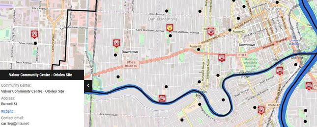
Community Center locations have now been added to the Winnipeg Map.    The list of community centers was compiled by Martina Gornik-Marion, a Public Health Dietitian with the WRHA, and geocoded for mapping by Ryan Shirtliffe of the Institute of Urban Studies, University of Winnipeg.   This layer contains Community Centers administered by the City of Winnipeg, the General Council of  Winnipeg Community Centers (GCWCC) as well as a number of independently run community centers.    
0 Comments


Leave a Reply.

    Archives

    September 2019
    March 2019
    November 2018
    October 2018
    December 2017

    Categories

    All
    Success Stories
    Updates

    RSS Feed

Picture

Manitoba Collaborative Data Portal
A Collective Impact Project coordinated by the
Social Planning Council of Winnipeg

Search the Site


​Quick Links

About the MBCDP
Getting Started
​Frequently Asked Questions
Blog
Sign-up for Update
Contact Us
  • Home
  • Mapping + Dashboards
    • Demographic Dashboards
    • Web Mapping === >
      • Interactive Web Maps
      • Data Dictionary
      • Queriable Layers
      • User Manuals
      • Video Tutorials
    • Mapping using Google Earth
    • WHR Client Lookup
    • Map Gallery
  • Knowledge Portals
    • Food and Nutrition Security
    • Transportation and Urban Design
    • Housing and Homelessness
    • Overdose and Drug Related Harms
    • Health Indicators 2019
  • Resources
    • Local Data Portals
    • National Data Portals
    • Training Resources
    • Manitoba Census Data Consortium === >
      • About
      • Private Access
    • Neighborhood Explorer Toolset
    • Update History
  • Help
    • About MbCDP
    • Getting Started
    • FAQs
    • Blog
    • Sign Up for Updates
    • Contact