Interactive Web Maps
Click below to access the interactive maps available through the MbCDP. These maps are authored using Mango Maps, an on-line web-based mapping too.
Be sure to check out the instructional manuals and video tutorials to learn about the full functionality available in these maps. These maps not only allow one to view map layers and data, they also allow the extraction of population counts for custom areas, the exploration of neighborhoods using Google Street View, the retrieval of detailed neighborhood census reports, and the production of compelling map outputs for presentations and reports.
Be sure to check out the instructional manuals and video tutorials to learn about the full functionality available in these maps. These maps not only allow one to view map layers and data, they also allow the extraction of population counts for custom areas, the exploration of neighborhoods using Google Street View, the retrieval of detailed neighborhood census reports, and the production of compelling map outputs for presentations and reports.
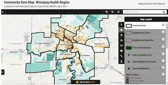 Click to Open the Community Data Map for the Winnipeg Health Region
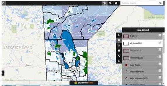 Click to open the Community Data Map for the Province of Manitoba