Map Gallery
As we collectively create paper based maps, we will make these available for download. These maps are in Adobe PDF format, and are in high enough resolution that they can be printed out in large format poster size.
Maps Produced by the Manitoba Collaborative Data Portal
MBCDP collaborators work together to create maps for public use. Click on any of the images below to download a map.
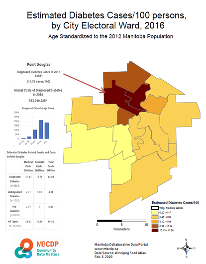
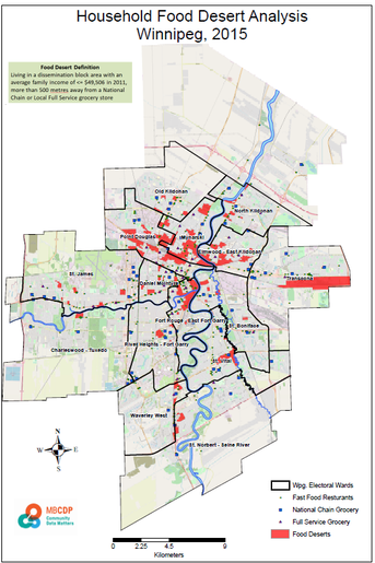
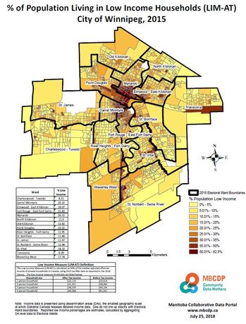
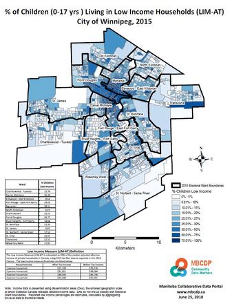
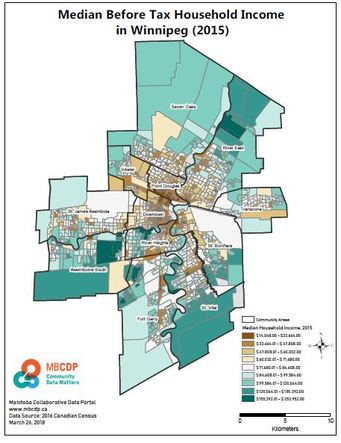
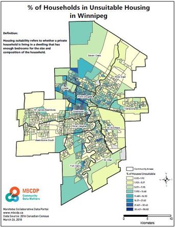
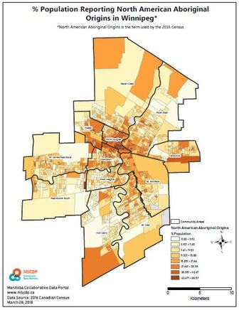
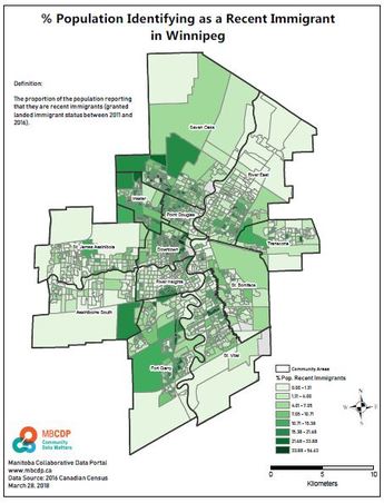
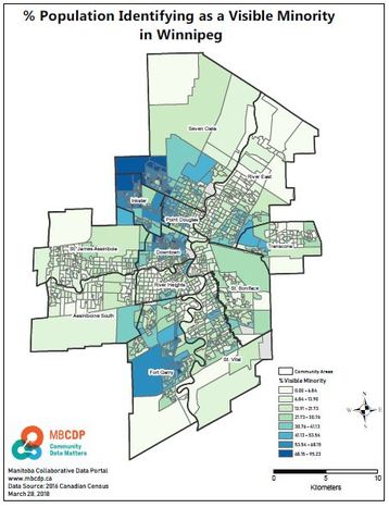
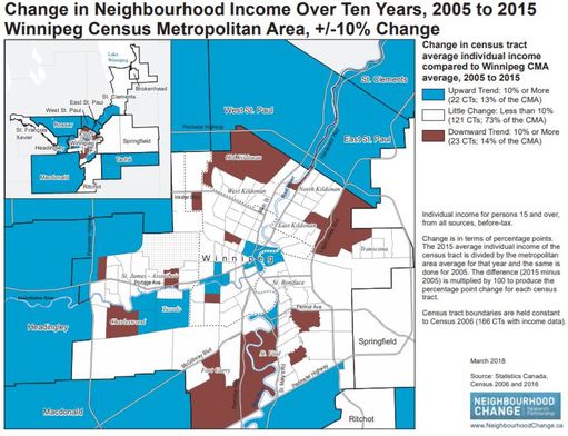
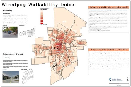
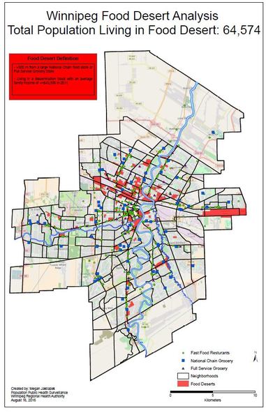
Winnipeg Maps
|
|
|
|
|
|
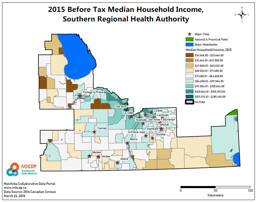
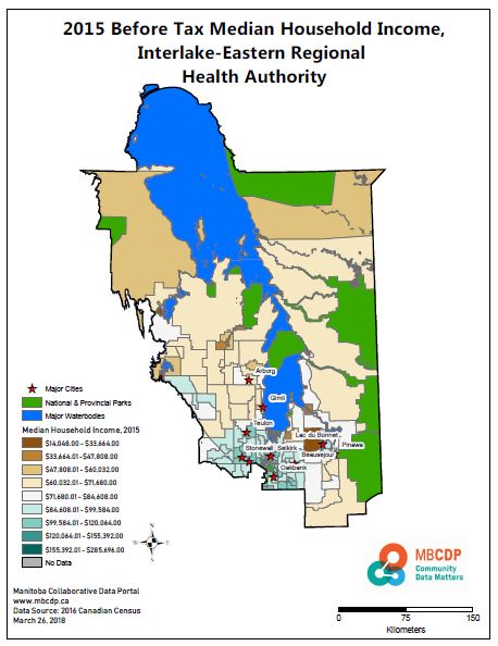
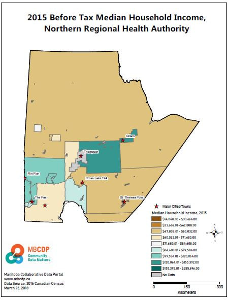
Rural Manitoba Maps
|
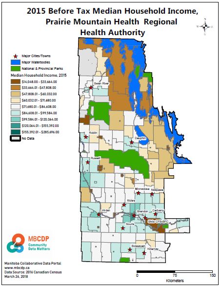
|
Maps produced by the Institute of Urban Studies, University of Winnipeg
Every month, the Institute of Urban Studies publishes their "Map of the Month". Each map illustrates an important topic related to the urban landscape in Winnipeg. Click the image below to navigate to the IUS web-site in order to view and download maps.
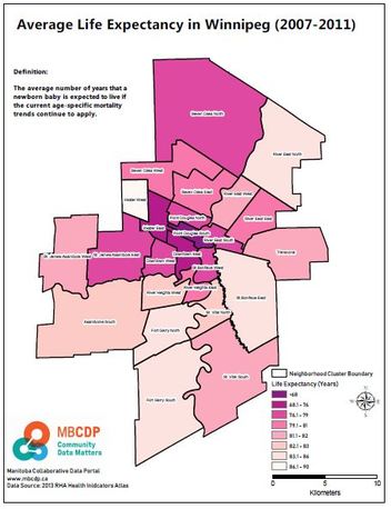
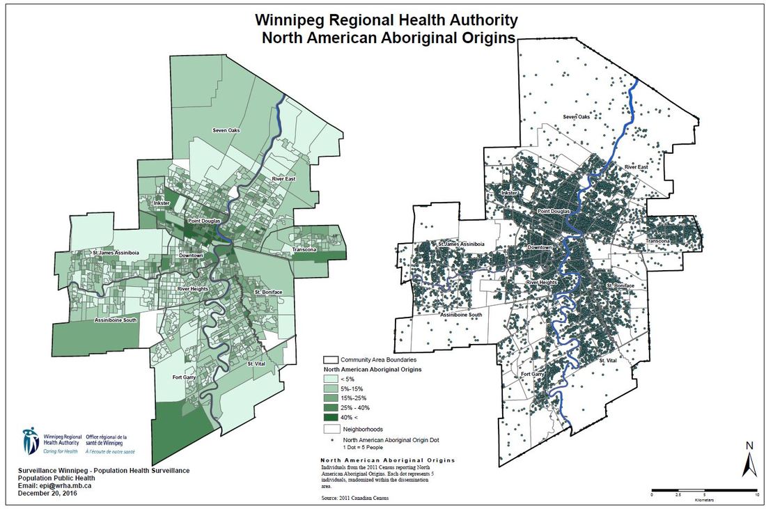
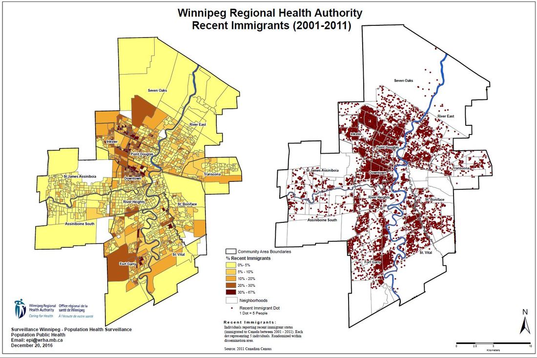
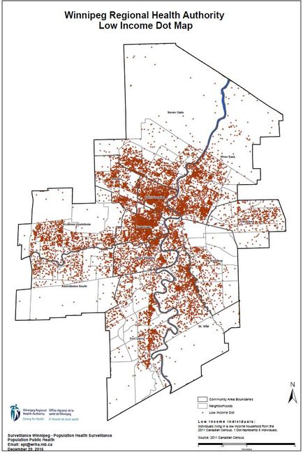
Maps produced by Population and Public Health, Winnipeg Regional Health Authority
Click on any of the images below to download a map.
|
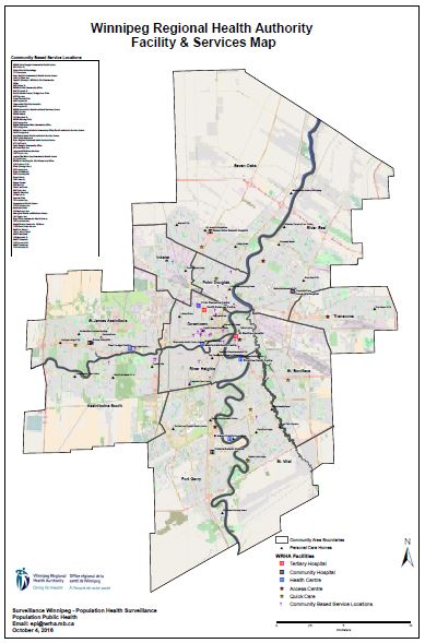
Note: This map does not reflect recent changes to health facility locations and functions that have occurred as result of health system transformation initiatives over the past 12 months.
|